-
Glenda Project Research Coastal Thermal Generators of Tornadoes
Researched by the Bayou Canada Research Facility we identified the generators of tornadoes in Dixie Alley, the most active tornado birthing location on planet earth. This presentation illustrates the mechanics of the atmosphere in conjunction with gravity and magnetic flows in the region to create tornadoes.
 Thermal Generation of Tornadoes
 -
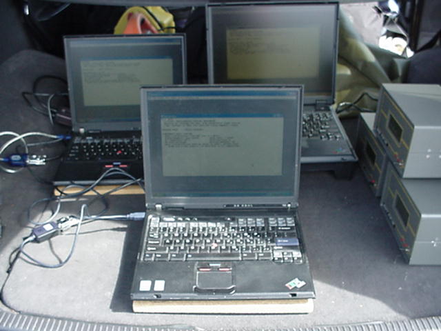
Glenda Project Data Files and Related Material
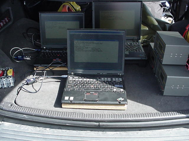
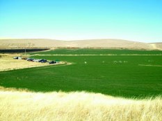
The following is a collection of data files and related material related to Glenda in the field operations:
04-27-15_LA_Prediction_Model1.pptx
031512_Groundstation_Email.xls
ARLISS-M%20Design%20Guide%201.0.pdf
Everett_Facility_03-16-14.xlsx
precusorverificationjan52007.jpg


09-03-14_Weatherpak_Test_60_Acres


10-11-17_Weatherpak_Test_60_Acres


COAA


Dayton_042216
digitalsonde2016042218Z_A4530199.txt
digitalsonde2016042300Z_A4530199.txt
digitalsonde2016042300Z_A4530199_ptu
groundtrack2016042200Z_A4530199.gpx
groundtrack2016042200Z_A4530199.txt
groundtrack2016042300Z_A4530199.gpx
groundtrack2016042300Z_A4530199.txt


Dayton_050705
Dayton_051411


Dayton_051813
digitalsonde2013051900Z_A4470844.txt
digitalsonde2013051900Z_B0450419.txt
digitalsonde2013051900Z_Z2057193.txt
groundtrack2013051900Z_Z2057193.gpx
groundtrack2013051900Z_Z2057193.txt
groundtrack2013051900Z_Z2057193.xls
Dayton_051913
051913_groundtrack2013052000Z_B0450419.txt
051913_groundtrack2013052000Z_B0450419.xls
BMR_051913_Sensors_Balloon.xlsx
digitalsonde2013051918Z_B0450419.txt
digitalsonde2013052000Z_B0450419.txt
groundtrack2013051918Z_B0450419.gpx
groundtrack2013051918Z_B0450419.txt
groundtrack2013052000Z_B0450419.gpx
groundtrack2013052000Z_B0450419.txt
Dayton_061105

Windspeed_061105_061205dtn.xls
Dayton_061111


digitalsonde2011061118Z_B0450419.txt
digitalsonde2011061118Z_B0450419_ptu.csv
digitalsonde2011061200Z_A4510903.txt
digitalsonde2011061200Z_A4510903_ptu.csv
groundtrack1970012912Z_A4510903.txt
groundtrack1970012912Z_B0450419.txt
groundtrack2011061118Z_B0450419.txt
groundtrack2011061200Z_A4510903.txt
Holux_061111_flight_dayton.csv
Holux_061111_flight_dayton.xls
Dayton_061315
06-13-15_Balloon_Simulation.pdf
06-13-15_Balloon_Simulation.pptx
06-13-15_Balloon_Sondemonitor.pdf
Dayton_WA_06-13-15_Balloon.xlsx
Dayton_WA_06-13-15_Balloon_Launch.pdf
Dayton_WA_06-13-15_Balloon_Launch.ppt
06-13-15_Balloon_Sondemonitor.ppt
2015061400Z_A4510997_metdata.txt
digitalsonde2015061400Z_A4510997.txt
digitalsonde2015061400Z_A4510997_ptu.csv
groundtrack2015061400Z_A4510997.gpx
groundtrack2015061400Z_A4510997.txt
digitalsonde2015061318Z_A4510997.txt
groundtrack2015061318Z_A4510997.gpx
Dayton_062312
062312_DTN_Corral_MadgeTech.xls
Sigma_Theta_062312_Overview.pdf
Sigma_Theta_062312_Overview.ppt
Photo of 6 23 Dayton Storm.msg


Dayton_091209


Dayton_091314


091214_GoPro.MP4
091314_Flight.avi
Dayton_091408
Dayton_091705
Dayton_091810
digitalsonde2010091900Z_A4510903.txt

Dayton_100111
flight_1_Fourier Systems LTD. 01-Oct-11 10.23.2.csv
Flight_3_Fourier Systems LTD. 01-Oct-11 11.48.29.csv
Flight3_Capsule_Valid_Add_1Hr.csv

Dayton_100111_Flight3_Holux_Updraft.xls
Dayton_General_Chase_Team
Monroe_WA_2010_Tornado
-
Flight History FLIGHT HISTORY & MILESTONES 1997 - Current
2011 - current
Milestones PLUS - See the Annual Report for all the numerous achievements that have taken place over the recent years and our current activities!
2010
Milestone: October 2010 - New Flight Control Room and satellite communication center put online
Launch 33: September 2010 – “4D” payload achieved first cloud “ingestion” collecting valuable updraft and
downdraft data plus wind shear velocities.
Milestone: September 2010 – Deployed new “High Velocity” booster and capsule to further expand the flight
envelope.2009
Milestone: September 2009 – Collected updraft and downdraft data from the “4D” payload in real time.
Launch 32: September 2009 – First flight of “4D” payload. (Lattitude, Longitude, Elevation, & motion)
Milestone: September 2009 – Incorporated Sink Rate profiling into the GPS capsule data analysis.2008
Milestone: July 2008 – Deployed Gamma Ray sensor and determined that Thunderstorms suppressed
Milestone: October 2007 - Edmonds, WA ground station operational as additional facility for sensor testing.
“background” radiation counts.
Milestone: September 2008 – First Flight of the GPS Wind Velocity payload which allows 3D mapping
capability of storm systems
2007 - Celebrating TEN YEARS of R&D
Launch 31: May 2007 – The new “Ranger Intercept” research rocket was successfully launched into a storm
front and captured live video which was downloaded to a ground station laptop.
Milestone: May 2007 – In conjunction with the Blue Mountain Rocketeers, participated in the National
Weather Service (Pendleton, OR) open house in celebration of the 200th birthday of the NOAA.
There was a great deal of interest in the project, with multiple presentations during the day including
overviews of the project, its capabilities, and demonstrating various aspects of the weather payloads
and the ground support equipment.
Milestone: Feb - June 2007 – Conducted several “Train the Trainer” courses in severe weather and storm
spotting for Emergency Management in Mississippi and the Gulf Coast
Milestone: 1/1/2007 - New Terrabyte server for data logging placed online for full operation with network control2006
Milestone: December 2006 - Raid 5 backup facilities on BSD Unix now online with full network live access
Milestone: December 2006 - Upgraded the Active Payloads from analog to digital signal transmission including GPS tracking and wnd velocity data.
Milestone: September 2006 - Completed design of a video recording payload in order to provide on board video capture of a wall cloud intercept.
Milestone: August 2006 - first chase vehicle equipped with ham communication gear.
Milestone: June 2006 - chase team qualified with ham licenses; first chase vehicle equipped with ham communication gear.
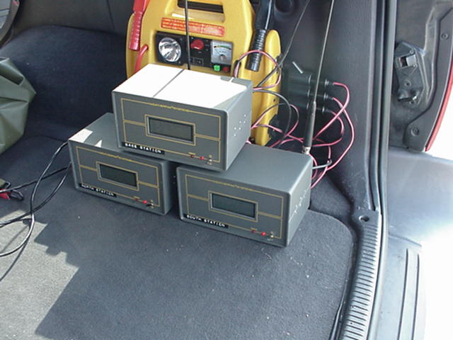
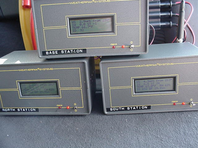
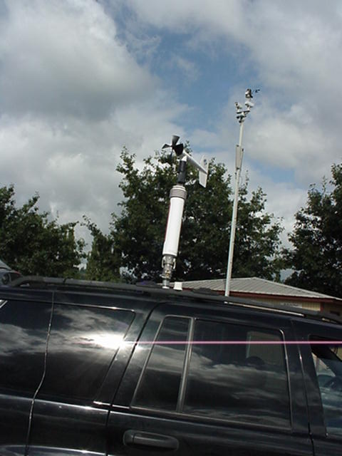
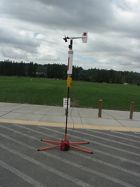
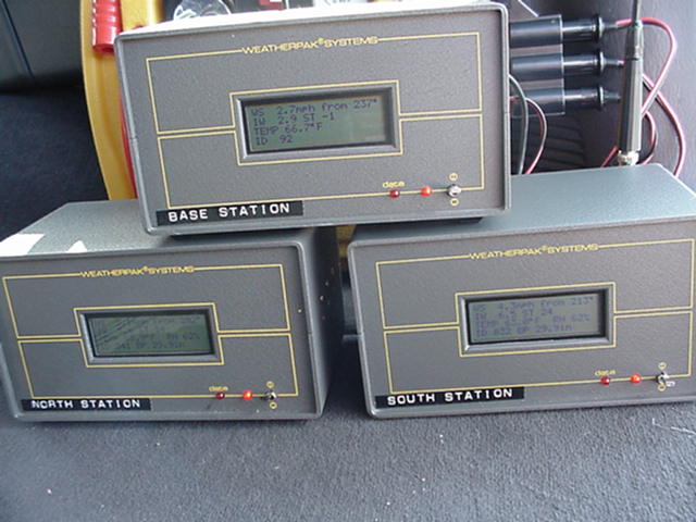
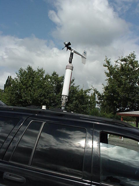
Milestone: May 2006 - Developed and implemented a multiple channel digital mobile groundstation with a one second data capture rate including wind speed, temperature, relative humidity and barometric pressure2005
Milestone: October/2005 - Introduction of 3D data model for testing of severe weather precursor signals.
Launch 30 - 09/17/05 - Dayton, WA - Lone Tree launch Site - First flight of the FAR 101 compliant booster with 4" payload capsule. Successful data recovery. We can now launch payloads to mid altitudes without having to request formal FAA waiver approval for flights.
Launch 29 - 09/17/05 - Dayton, WA - Lone Tree Launch Site - Second flight of the 3" capsule on the 4" booster. Marginal data capture. Recovery system tested to maximum flight loads and maintained functionality.
Launch 28 - 06/11/05 - Dayton, WA - Lone Tree Launch Site - First flight of the redesigned 3" capsule on the 4" booster. Successful data capture from the payload.
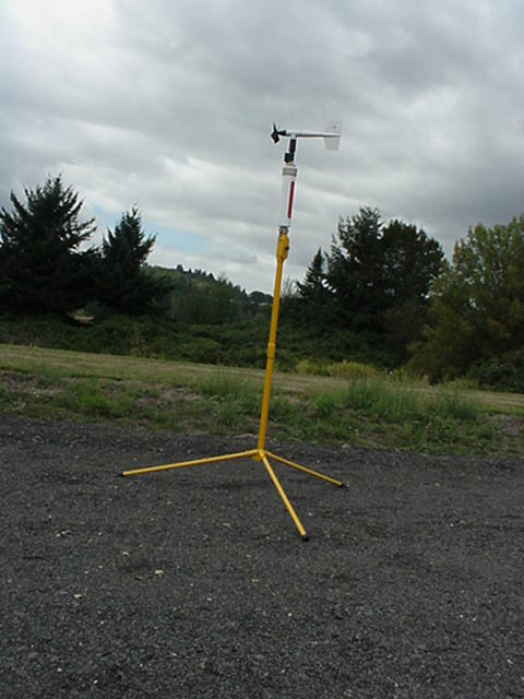
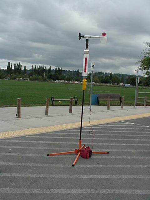
Milestone: 06/11/2005 - Dayton, WA - First use of integrated ground station data collection with temperature, barometric pressure, relative humidity, windspeed, and cloud base altitude begin digitally recorded simultaneously.
Milestone: 06/11/2005 - Dayton, WA - First use of 3D modeling for ground station data integration.
Milestone: June/2005 - Addition of Tim Quigg to the Glenda Team
Milestone: 05/15/2005 - First complete run through of GITA enabled Chase Vehicle with full TMobile computer communication capability
Milestone: 05/07/2005 - First use of digital anemometer data recording
Milestone: 05/07/2005 - First use of digital radiological data recording
Milestone: 04/09/2005 - First use of TMQ-34 military weather station2004
Launch 27 - 09/25/2004 - First operational mission of active data transmission payload plus supporting datalogger flights
Launch 26 - 05/08/2004 - First use of digital software recording of temperature, RH, and baro data2003
No milestone activity for 2003 - however, a lot of development work
2002
Launch 25 - 10/11/2002 - First Flight of a triple payload of two dataloggers plus tracking transmitter
Launch 24 - 09/20/2002 - First Flight of Dual Payload of datalogger and tracking transmitter
Launch 23 - 06/08/2002 - First Dual Launch - of two vehicles simultaneously
Launch 22 - 06/08/2002 - First Use of ground station equipment manually recording temperature, humidity, barometric pressure, and winspeed
Launch 21 - 06/08/2002 - First Flight of Audio Tracking Locator
Launch 20 - 06/08/2002 - First Flight of CTI powered booster with active transmission payload
Launch 19 - 04/13/2002 - First Flight of the Temp/RH datalogger package2001
October 2001 - SCRUBBED- Tested Instrument Packages on ground at Dayton, Washington facility - winds too high to launch.
Launch 18 - July 14, 2001 - Successful - First fully operation payload launch of telemetry equipment and radiosonde weather instruments from Dayton, Washington facility.- Tested at 20Gs fully active.
- Continuous feed of data from instruments during and after recovery with no interruptions or failures.
- First attempted commercial payload delivery and recovery successful
Launches 14, 15, 16, 17 - May 12, 2001 - Back with a vengenance - 4 Successful launches from Dayton, Washington facility operations of Blue Mountain Rocketeers:
- One of a Kind - First test of HASPDV Project engines on first test of rocket for orbital operations. Initial launch broke sound barrier 4 feet off launch rail. Alititude and burn time classified.
- Rocsam 1 and Rocsam 1A dual rocket launch to test rapid deploy and launch system of Thunderockets in field operations.
- Two Stage MAPS !C launched to test scalability and configuration. Second stage broke sound barrier on ignition.
2000
Summer - 2000 Flight Operations have been restricted due to high burn hazards at launch locations. We are currently working to establish a new launch facility to increase the launch regularity.
Launches 12, 13 - Spring 2000 - Successful launch of Thunderocket. Two flights to test system and operations
1999
October 1999:SCRUBBED - Weather; TWIN UNIT LAUNCH of 2 LASRDV's (Lower Atmosphere Suborbital Research Delivery Vehicle)TM; Modified D Region Tomahawk Missile design - Moses Lake, WA - test advanced recovery & guidance, data aquisition system; test color video transmission system; Atmospheric gas sampling unit testing; advanced engine systems; test ground station tracking of twin rockets under simultaneous launch with Automatic Position Reporting System; Estimated Altitude 16,000 feet.
September 1999: SCRUBBED - Weather; LASRDV (Lower Atmosphere Suborbital Research Delivery Vehicle)TM - location Monroe, WA; test recovery, guidance and communication systems; shake down flight.
Launches 9, 10, 11 - March/April 1999: Successful - multiple launches of Alice(1) and Fergie 1(2) to test new composite engines; Moses Lake Launch Site. Top Altitude 6000 feet.
1998
December 1998: SCRUBBED - Weather; Viper IV Vehicle Fergie I - Monroe, WA; 4 ground lit composite E moters; Estimated Altitude 5000 feet.
December 1998: SCRUBBED - Weather; Loc IV Vehicle Alice - Monroe, WA; test data aquisition system; test ground station tracking Automatic Position Reporting System; Estimated Altitude 5000 feet.
Launch 8: September 6, 1998: Monroe Washington; Viper IV Fergie 1; 2 D Engines air started after 2 composite E Engines; Estimated Altitude 3500 feet. Fact Sheet
August 2, 1998: SCRUBBED - staff personal emergency; Viper IV Fergie I - Monroe, WA; 2 staged (*) engines; Estimated Altitude 5000'
Engine Test: Sucessful August 2, 1998: Engine rental to client - one of three cluster performed perfect.
July 11, 1998: SCRUBBED - Weather; Viper IV Vehicle Fergie I - Kent, WA; 2 staged (8) engines; Estimated Altitude 5000 feet.
June 1998: SCRUBBED - Weather; Viper IV Vehicle Fergie I - Kent, WA; test new cluster ignition system, new engines; Estimated Altitude 5000 feet.
June 1998: SCRUBBED - Weather; Engine Test: 38mm burn - Monroe, WA.
June 1998: SCRUBBED - Weather; Engine Test: 54mm burn - Monroe, WA.
Launch 7 - April 26, 1998 Fergie I @ Sheridan, OR
Launch 6 - April 26, 1998 Alice @ Sheridan, OR Fact Sheet
Launch 5 - April 25, 1998 Fergie I @ Sheridan, OR
Launch 4 - April 25, 1998 Fergie I @ Sheridan, OR
Launch 3 - April 25, 1998 Alice @ Sheridan, OR
Launch 2 - April 1, 1998 Fergie I @ Monroe, WA - Fact Sheet
Launch 1 - April 1, 1998 Fergie 1 @ Monroe, WA - Fact Sheet
1997
Founded Glenda Project
-


